Latest Maptek technology on show at CIM Booth 2009
Monday, May 11th, 2015
Integrated technology adds value to companies operating in an uncertain climate. It provides opportunities to identify and resolve inefficiencies, and streamline processes. In the last six months Maptek has released four software upgrades, two new laser-based survey solutions, and added a strategic and tactical open pit scheduler.
Practical insights into the use of technical mining data have been gained from 35 years of developing innovative 3D CAD and visualisation systems for survey, geological modelling, design, mine planning and scheduling.
The latest Maptek technology that improves operational workflow will be demonstrated in Booth 2009 at this year’s CIM convention in Montreal.
Underground mine planning tools were revitalised with the Vulcan 9.1 release in late 2014. Level Designer allows many different layouts to be run without designing each level in detail. These can be easily assessed, and a combination of scenarios can be chosen for development using Stope Optimiser. The new Gantt Scheduler then allows users to create activities, sequence and allocate resources. Schedule reports can be shared efficiently and animated for easy validation. The transparent workflow provides a significant increase in productivity for underground design.
Maptek solutions are designed to allow mine planners to spend more time on critical analysis and decision. Automated workflows that also take advantage of computing power reduce time spent in processing data. Both Level Designer and Pit Optimiser provide quick previews for the planning experts to decide which designs are worth developing.
Visitors to CIM will be able to experience new Maptek Evolution strategic optimisation software first-hand. Evolution creates dynamic schedules using a cut-off grade optimisation approach, widely considered to be the most effective way to maximise NPV (net present value). Integrating Evolution with Maptek Vulcan mine planning software will generate a practical solution for mine planners.
Maptek has leveraged more than 15 years’ experience in the laser scanning field to release two new digital survey systems. Maptek Sentry contains intuitive visualisation and trend analysis tools, enabling better understanding of surface movements tracked by laser scanning. The same point cloud data can also be used for other measurement and geotechnical tasks. Surface movement tracking can be halted temporarily so that the laser scanner can be used for survey in other parts of the mine.

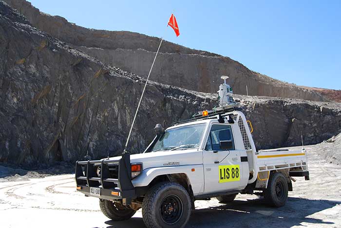
I-Site Drive, released earlier this year, is a flexible and cost-effective system for continuous data acquisition. Volumes can be easily calculated and reconciled by connecting an I-Site laser scanner with GPS togenerate a profile as a stockpile is circumnavigated. Data collection is significantly faster and surveyors remain within the safety of their vehicle.
CIM visitors can see the benefits of these solutions and workflows for themselves by visiting Maptek at Booth 2009.


