I-Site Studio 5.0 boosts survey workflow and productivity
Thursday, July 10th, 2014
Maptek™ I-Site™ Studio 5.0 delivers new features and improvements to existing software tools to further boost survey efficiency and productivity.
Maptek I-Site laser scan technology features familiar workflow and integration with site survey practices. I-Site Studio software brings out the real value in the scan data – superb accuracy and flexible reporting.
‘Less time in the field. Less time at your desk, is our mantra,’ said Maptek Manager of Laser Imaging Systems, Athy Kalatzis. ‘Automating processes helps surveyors generate timely and accurate survey reports for planning and production, with positive impacts on site productivity.’
I-Site laser imaging systems capture incredible detail from scenes, with software that can handle large data without the hassle. I-Site Studio 5.0 applies a new Level of Detail tool to object data, allowing a manageable amount of data to be loaded and viewed at once.
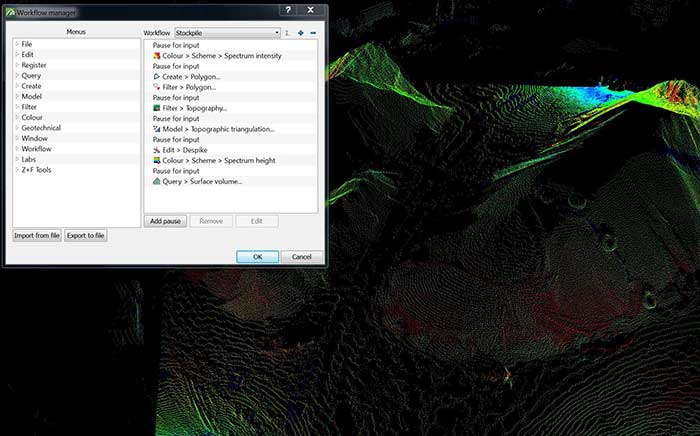
The new Workflow Manager saves a series of transactions which are then shared and adapted within survey teams. This enables standard work processes to be implemented across an organisation – driving productivity, efficiency and accuracy. Workflows can be launched from custom toolbars, and the status of the current process is conveniently highlighted. The result is efficient handover between crews for routine site applications.

New workflow manager streamlines survey tasks
‘In addition to being a valuable training tool, standardised workflows improve quality and consistency of results,’ said Kalatzis.
Tolerance ellipsoids and smart sampling in I-Site Studio 5.0 deliver a more streamlined global registration process. Multiple scans from the same location can be moved together as a group. It is now possible to register two scans unlevelled, but constrained to a GPS point.
The Combination surface tool allows a new surface to be outside the original surface, which is often the case when mining operations expand. The function will generate a new solid even without completely closed intersections between surfaces.
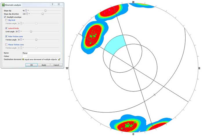
Additions to the Geotechnical Module allow easier analysis of different failure modes and more intuitive display of results. A maximum discontinuity area can now be specified when extracting discontinuities and users can run kinematic analysis for potential failure types such as wedge, planar and toppling.
Stereonet display improvements include type, grid style and scalable pole size. The great circle tool now auto-populates from a stereonet selection, saving time and effort. A new wizard-style interface for filtering vegetation makes it easy to remove objects above evenly distributed low points in a selection. A distance from ground slider dynamically updates the view of what is to be removed.

More options are now available for geotechnical analysis
Advanced visualisation is a hallmark of Maptek software systems. A 360º panoramic image captured with any digital device can now be draped over an I-Site point cloud and up to 7 images can be rendered to a single surface.
Usability enhancements include more import/export options; a new Maptek file format supports transfer of any object between Maptek applications; default legends for colouring objects; saving views; licence borrowing; and new reporting formats.
‘The right tools are an important part of the mine productivity matrix. What surveyors need is an integrated, systematic approach to data capture and processing. This is what I-Site Studio 5.0 delivers to produce the results they need even quicker,’ concluded Kalatzis.


