3D Geological Modelling
Geological modelling software for open pit and underground mining operations
Maptek Data System
Maptek Compute Framework
Maptek Orchestration Environment
Join our early access program to unlock value for your organisation.
Drill & blast management
Interconnected mine scheduling
Reliable proximity awareness underground
Dynamic survey surface updates
3D mine planning & geological modelling
Streamlined geological modelling workflow
Machine learning assisted domain modelling
Material tracking & reconciliation systems
3D laser scanning & imaging
Point cloud processing & analysis
LiDAR-based stability & convergence monitoring
Derive value from airborne or mobile sensor data
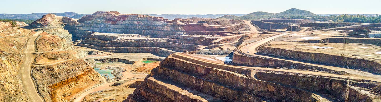
Geological modelling software for open pit and underground mining operations
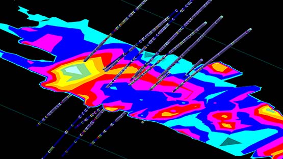
Maptek Vulcan helps you to make sense of your geological data. Interpret the most complex geology and create 3D resource models that are transparent, reliable and repeatable.
Manage and visualise very large and complex datasets, process the information and rapidly generate models. Vulcan’s sophisticated algorithms and fast processing allow virtually instant validation of data for building and maintaining up-to-date models of a deposit.
See how Klondex Mines used Vulcan to enhance interpretation at a narrow vein deposit
Read MoreVulcan has both. We've developed an advanced selection of both automated and manual modelling tools. Our customers like the choice.
Our implicit modeller creates models that are repeatable and accountable, for both grades and categories. You control user parameters, there are no black boxes.
Take ultimate control of your geological information. Modify solids and surfaces in freehand mode by pinching and smoothing to better represent geological interpretation and speed up the decision making process across the entire mine.
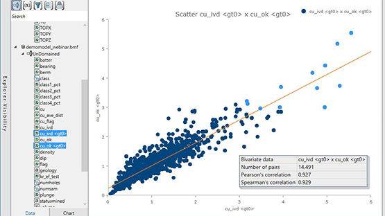
Gain a better understanding of technical data for resource modelling. Our streamlined interface integrates variogram analysis for structural and grade based anisotropy.
We’ve used our decades of experience and constant customer feedback to create packages and specialised tools for almost every deposit and operation, including yours. We can also design a custom configuration for your operation.
It doesn't end there. We can streamline your workflows and provide expert training to help you and your team hit the ground running.
You can choose from a range of short to long term subscription options.
So if you're a consultant working on a month long contract, or the head of a permanent team of geologists at a mine site, our licensing options will suit your needs.
If you encounter an issue (it happens to all of us) or if you need expert advice, Maptek's global network of support teams is on hand to help you at almost any hour of the day.
And when you call or email us, you'll get straight through to experienced geologists, surveyors, mining engineers and geotechs.
ReCAPTCHA has failed to load! Try reloading the page to submit this form. ReCAPTCHA no se ha podido cargar. Intente volver a cargar la página para enviar este formulario. Não foi possível carregar ReCAPTCHA. Tente recarregar a página para enviar este formulário. Не удалось загрузить ReCAPTCHA. Попробуйте перезагрузить страницу, чтобы отправить эту форму.
We use cookies to enhance your browsing experience and analyse our traffic. By clicking "Accept all", you consent to our use of cookies. You can customise your cookie preferences by clicking 'Customise Preferences'.
We use cookies to enhance your browsing experience and analyse our traffic.
Our website may store cookies on your computer in order to improve and customise your future visits to the website. By using cookies, we can track information about your usage of the site and improve your experience with anonymous and aggregated user data.
Review our Privacy PolicyEssential for the website's functionality, without which the site cannot operate smoothly.
Remember user preferences and choices to provide a more personalized experience.
Collect data on how users interact with the website, helping to improve user experience.
Used to deliver targeted advertisements to users based on their browsing behavior and preferences.