June 2024 Issue Index
Safeguarding legacy mine sites
LiDAR mapping together with point cloud visualisation and modelling software provides an integrated solution that helps safeguard legacy mine sites in Missouri.
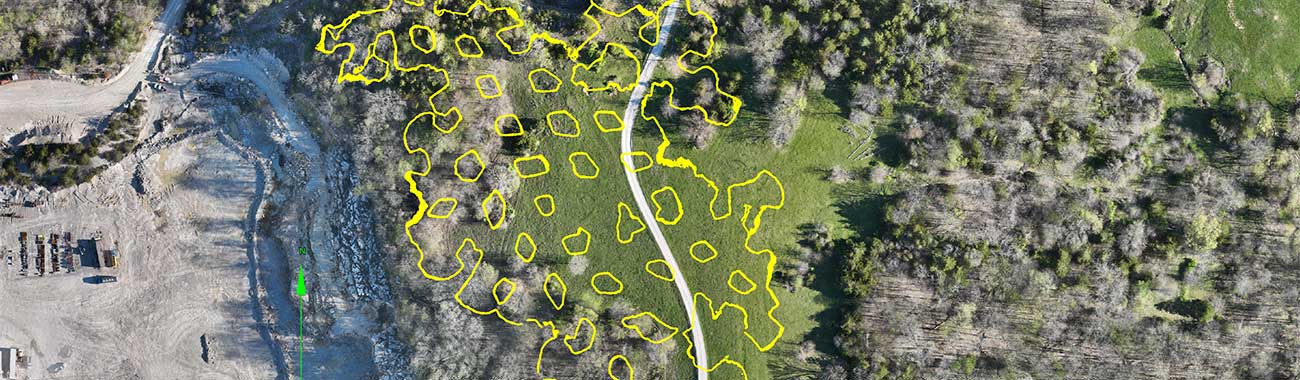
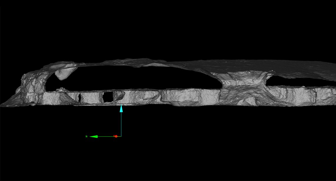
The Capital Aggregates HWY 63N site near Jefferson City, Missouri contains extensive underground workings from past aggregate mining operations.
To evaluate residual hazards, ensure personnel safety, and enable efficient extraction of remaining reserves, Capital Aggregates partnered with Wingfield Scale & Measure Company to deploy an integrated LiDAR mapping solution.
Morgan Powell, Wingfield Senior Geospatial Analyst and Geologist, processed underground SLAM (Simultaneous Localisation and Mapping) data from 2018 scans at the site using Maptek™ PointStudio™ software.
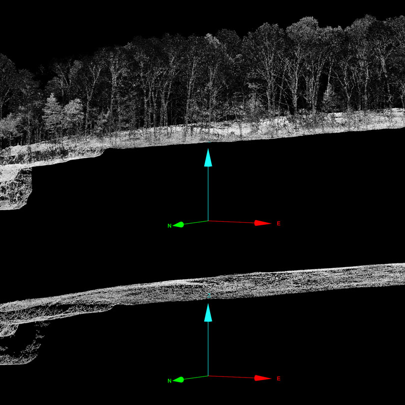
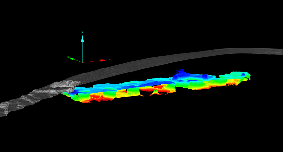
UAV and terrestrial LiDAR was captured and combined with the old underground point clouds to generate a comprehensive and georeferenced 3D model of the surface and subsurface.
‘Maptek’s powerful point cloud engine allowed us to precisely integrate and analyse the old underground scans against the current surface model,’ said Powell.
Capital Aggregates gained a comprehensive 3D visualisation for evaluating residual hazards and planning mitigation approaches around the legacy mine site.
‘The key benefit of the LiDAR survey was in allowing us to coordinate and verify the integrity of the 2018 scan data and accurately orient it to the current surface model,’ said Cole Meier, Inventory Manager at Capital Aggregates.
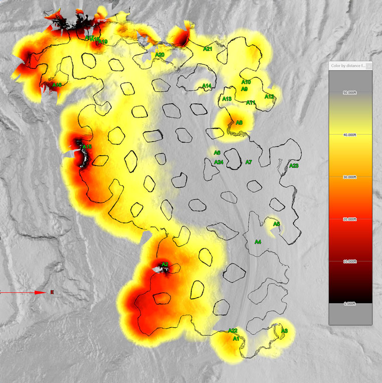
‘This enables precise mapping of underground extents, pillars and hazardous areas onto the surface to plan safe, efficient reserve recovery through the abandoned mine workings.’
A critical challenge was identifying potential hazards such as roof collapses, inadequate overburden thickness and subsidence features that could impact personnel safety and future development.
Wingfield’s innovative approach fused the current aerial LiDAR topography, previous underground terrestrial scanning, and robust survey-grade GPS ground control—all seamlessly integrated within PointStudio.
Accurately surveyed subsurface features enabled Capital Aggregates to increase drilling and blasting efficiency, minimise delays and prioritise safety while extracting reserves through areas with abandoned workings beneath.
‘Without this data pinpointing areas of concern, the project would have been impossible,’ said Meier.
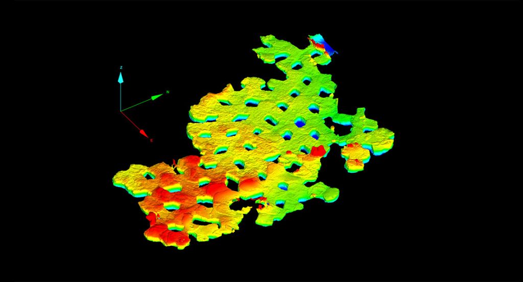
Powell leveraged specialised overburden analysis tools within PointStudio to map four zones exhibiting potential roof collapse areas breaching the surface, as well as multiple zones where overburden thickness may be inadequate based on 2018 underground data.
The single most valuable aspect was delineating the mine extents, pillars and unstable areas onto the surface terrains so we could barricade off hazardous zones and ensure the safety of personnel.
While unable to confirm the current underground state, the findings highlighted hazards requiring monitoring and mitigation. Wingfield recommended follow-up surveys to clearly demarcate areas of concern until more extensive underground investigation is feasible.
The project exemplified how LiDAR mapping integrated with Maptek modelling software provided comprehensive visualisations and analysis pinpointing residual hazards around legacy mining areas.
This proactive approach allows Capital Aggregates to stay ahead of potential hazards, optimise operations and prioritise safety across their dynamic quarry environment.
Thanks to
Wingfield Scale & Measure
- James Kenney, CTO
- Morgan Powell, Senior Geospatial Analyst and Geologist
- Hunter Johnson, Field Technician II
Capital Aggregates
- Cole Meier, Inventory Manager
- Chris Williams, VP of Operations
- LiDAR mapping integrated with Maptek modelling software enabled visualisation and analysis, pinpointing residual hazards around legacy mining areas
- Hazards include roof collapses, inadequate overburden thickness and areas prone to subsidence that could potentially impact safety and future mine development
- Hazards requiring monitoring and mitigation, and areas of concern are now mapped pending further investigation