June 2024 Issue Index
Monitoring deformation underground
Maptek laser scanning hardware and software make it possible to track deformation of underground workings at a gold mine in Canada.
A gold mining company approached Maptek for help in measuring the deformation of underground workings exposed to high stresses, to optimise ground support in an underground mine located in Quebec.
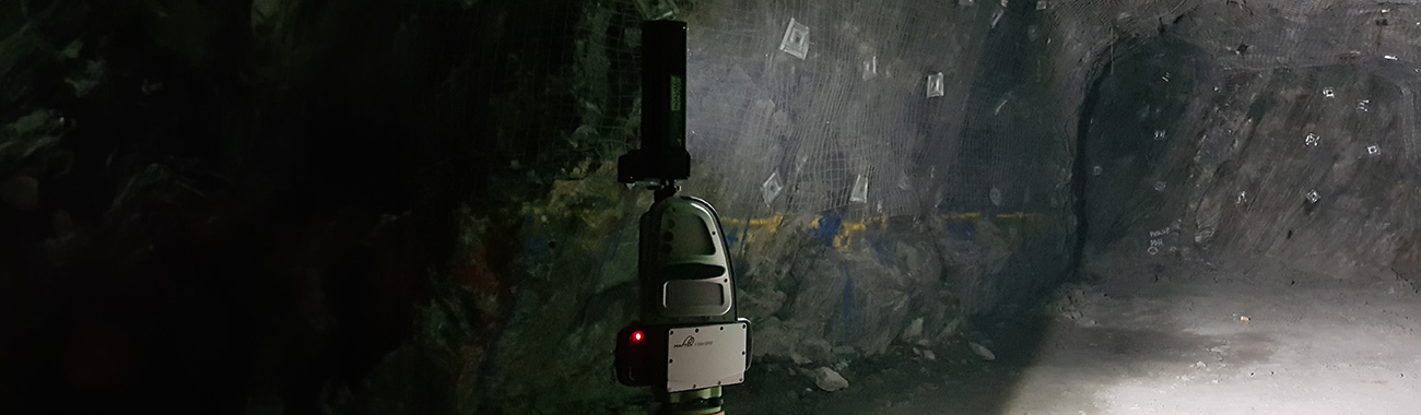
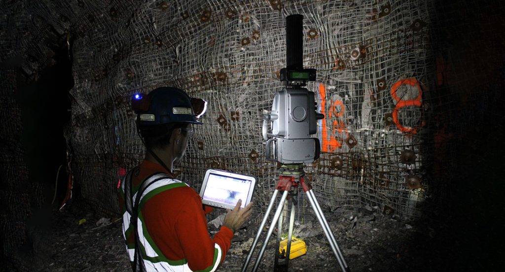
A Maptek SR3 laser scanner is deployed at the mine to capture point cloud data for monitoring deformation in workings exposed to seismicity or where unfavourable geomechanical properties can be found, as well as for geological mapping. Maptek PointStudio software is used for modelling, analysis and reporting.
Previously, convergence monitoring of underground workings was conducted using in situ observations and comments from workers.
In certain instances, the structural deformation has become so great that equipment has difficulty moving without damaging ground support.
Implementing Maptek technology for convergence analysis enables the ground control team to quantify the rate of convergence to optimise the orientation and dimensions of the openings.
Considering the vast extent of the mine and the time investment required to travel to an area underground, the Maptek solution provides excellent quality videos that accurately replicate reality.
The system is simple to use and provides excellent precision, with laser scan data enabling engineers to assess locations without the necessity to observe firsthand.
The solution also provides more useful field data than photographs for informing decision making, with detail preserved for future needs.
Bringing the information to the surface is a significant time saving for mine geologists and engineers and facilitates decision making and information sharing.
Data accuracy and ease of acquiring data in the field were the most important factors for choosing Maptek.
The Maptek solution is used by multiple teams at the mine.
- Ground control department for convergence monitoring
- Video capture for decision making
- Dimensional measurement and volume estimation
- Monitoring shotcrete quantities
- Construction department for precision georeferenced 3D surveys
- Geology department for cartography
The most important benefit of the implementation is acquiring comprehensive information that enables the safest possible decisions to be made.
The collaboration with Maptek is a positive benefit to the mine, and valuable relationships have been formed.
- Latest hardware and software technology replaces photographs and recorded comments for tracking deformation in underground workings
- Technology approach delivers detailed field data that would otherwise be difficult to obtain considering the size of the underground operation, and preserves data for future analysis
- Accurate capture of geospatial data and timeliness of reporting enable decisions that ensure the safety of people and equipment
Maptek R3 mkII series laser scanners
The Maptek scanner is a reliable, precise tool, making it very easy to acquire data underground. PointStudio software provides excellent visualisation and modelling tools.