June 2024 Issue Index
Laying the groundwork for value
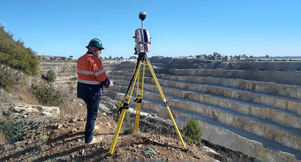
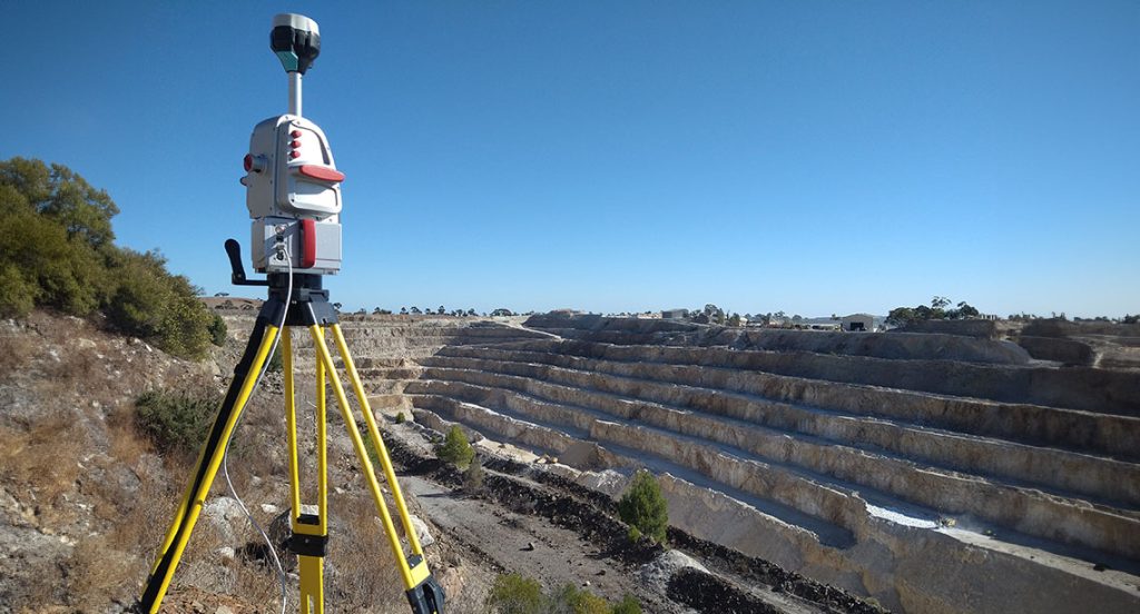
High demand for slope stability assessments led a consulting company to pivot towards acquiring a Maptek LR3 laser scanner for in-house monitoring services.
Groundwork, part of SLR Consulting, provides professional geoscience, environmental science, planning and development consultancy services to the mining, quarrying, construction, land use development, power generation and waste management industries.
The Groundwork team provides a range of geotechnical services for quarry development and management including:
- Rock exploration and appraisal
- Drilling campaigns
- Geotechnical engineering, assessments and design
- Ground control management plans (GCMPs)
- Slope stability assessments
While undertaking GCMPs and slope stability assessments, Groundwork had previously contracted Maptek to map and monitor wall movement. The usefulness of the data acquired gave Groundwork insight into the value of Maptek hardware and software systems.
‘Under pressure from a growing workload and high demand for stability assessments, we decided to procure our own scanner,’ said Tristan Throup, Operational Consultant, Groundwork.
Maptek assisted the Groundwork team in the transition and provided all the relevant historical data for them to continue the services with their own equipment.
‘We could continue wall monitoring and deformation reporting to our clients, while also being responsive to specific requests,’ Throup said.
Providing this service in-house has immensely grown Groundwork’s internal capability. The geotechnical engineers can make more informed decisions with confidence in the accuracy of the data.
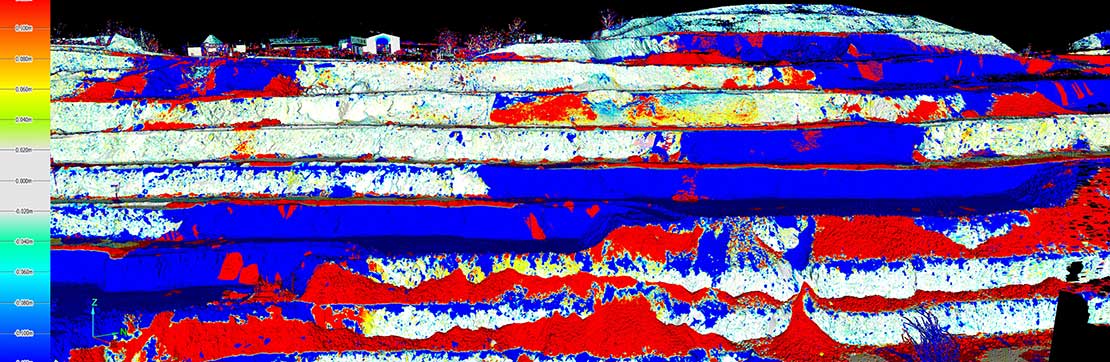
Clients have noted the level of detail they can now observe from small rock falls, erosion or slumping. This is particularly evident for slow moving events that might not otherwise be detectable.
The data helps clients to understand events they may not have realised were happening, allowing proactive management before issues escalate.
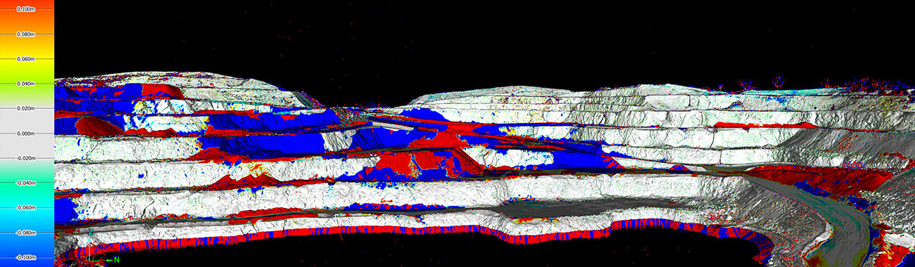
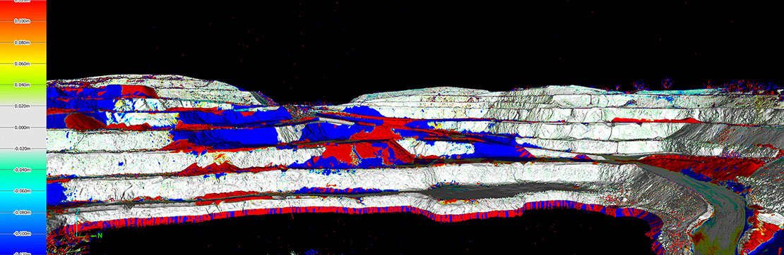
Groundwork mainly uses the laser scanner on quarry pit walls. The datasets are easily registered using Maptek PointStudio software and the distance to object tool helps analyse and compare data from a previous or historic dataset. The team can then inspect any areas of movement in the walls.
Groundwork now has a versatile system for scanning internal environments and undertaking undercover stockpile surveys, where drone or photogrammetry access would be difficult. They can now accurately measure and calculate stockpile volumes.
Throup said that the scanning workflow is straightforward, depending on field of view and distance.
‘Our staff are surprised how quick and easy it is to set up and use, register data and then measure distance to objects to report on deformation,’ Throup said.
Groundwork has considered other applications, such as creation of pit models where a drone flight is restricted, or underground/tunnel scanning projects.
Groundwork aspires to be a leading provider in geotechnical support and advice, with efficient and responsive in-house services for clients. Professional development opportunities have been created for personnel to learn new equipment and technology.
For Groundwork, the biggest benefit from using Maptek technology is gaining direct access to data that can be used to inform safe extraction practices in quarry and mining projects.
‘Support from Maptek has been excellent. Safety is the biggest driver, so being able to provide advisory services to clients supported by tangible scan data means we are doing our best to ensure everyone goes home safely,’ concluded Throup.
For the future, Groundwork is considering the PointStudio Geotechnical Tools add-on for conducting further geotechnical assessments and managing geotechnical risks in the quarry environment. They are also exploring opportunities to use Maptek Sentry for real-time wall monitoring.
Thanks to
Tristan Throup,
Operational Consultant
Groundwork Pty Ltd
- High demand for wall monitoring, ground control and slope stability assessments led to acquisition of Maptek laser scanner
- Technology provides digital access to detailed point cloud data that can be used to inform safe extraction practices in quarry and mining projects
- Geotechnical engineers can make more informed decisions with confidence in the accuracy of the data
Geotechnical Tools
Geotechnical Tools can be added to PointStudio and PointModeller licences for extracting structures from point clouds and conducting analysis of structural data. Smart tools enable fast and accurate identification and mapping of structures, including the ability to quickly identify and group joint sets as well as record attributes about the structures.
Created stereonets interactively link to the 3D discontinuities used to create them, enabling users to identify the high risk structures in the real world.
Kinematic analysis options handle planar, wedge and toppling failures with automatic failure zone shading and metrics on high risk structures. Stability analysis is enhanced via a number of advanced analysis features such as the ability to measure waviness, spacing and potential wedge failure size, and identify drilling direction blind zones.
Intuitive tools and workflows combined with true 3D visualisation help operations better understand potential failure zones and manage risks. Detailed visual reports guide design, planning and operational decisions.