June 2020 Issue Index
Digital mapping drives efficiency
Transforming a paper-based process into a digital workflow has reduced the time taken to complete underground mapping by two-thirds.
Newcrest Mining is the largest gold producer listed on the Australian Securities Exchange and one of the world’s largest gold mining companies.
Newcrest’s Telfer Mine is located in the Pilbara region of the Great Sandy Desert in Western Australia. Its annual production of some 450 koz gold and 15 kt copper comes from an extensive underground operation and two open pits.
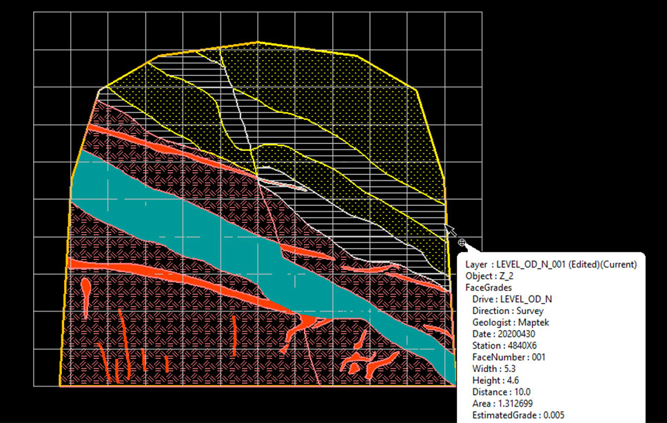
A Maptek digital solution introduced to the site in late 2019 allows geologists to map underground faces directly into Maptek Vulcan in the field using a ruggedised tablet.
CAD lines and polygons can be drawn over georeferenced scan data or images to quickly and clearly illustrate the geology.

The Maptek tool automatically builds mutually exclusive polygons, allowing accurate polygon areas to be calculated. Auto-calculation of weighted face grades eliminates manual calculations using a planimeter and spreadsheets.
Attributes such as grades can be recorded, structure types captured, notes entered and measurements digitised and written back to corporate databases for use with other Vulcan tools, such as those for geotechnical analysis.
Users can adjust the face position (and associated sample line) after it has been mapped, to align with survey pickup data.
Victoria Peterson, Specialist Geologist – Geological Modelling for Newcrest Mining, explained that underground mapping was previously conducted either in the traditional pen and paper form, or retrospectively using georeferenced images in Vulcan.
‘Both methods take considerable time to complete and are onerous in a dynamic production environment, which can impact the accuracy of the data captured,’ Peterson said.
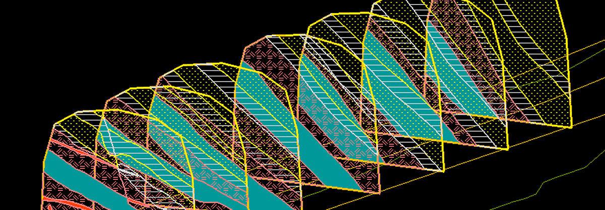
The new solution allows geologists to map all lithologies, mineralisation and structures observed as well as create sample lines across the mapping area. On returning to the office from underground the mapping data is instantly uploaded into their geological database, along with the sample lines that are converted into drillholes.
At this point all geologists in the team, including staff working in head office, can access the data for use in downstream processes such as 3D modelling.
The digital mapping solution reduces the time taken to map and process an area to around one-third of that using older methods.
‘And because every feature mapped is flagged and stored in a database it is easy to filter the information. This is especially useful given the size and geological complexity of the deposit,’ continued Peterson.
‘Working with Maptek has been a pleasure; both parties understand and are driven to improve the processes and tasks essential to mine geologists. The solution is well thought out, easy to use and efficient,’ she said.
The next step is to explore using the digital mapping approach in our open pits at Telfer.
Maptek Technical Services Consultant, Daniel Owen has worked closely with Telfer on the development and implementation.
‘One thing that we geologists all seem to have in common is a dislike of the tedious manual process of digitising face maps and bringing them into our 3D digital workspace,’ Owen said.
‘It’s exciting to see this digital mapping approach in action. We can work with Telfer and other sites to create potential new avenues for greater efficiency using these tools.’
An upcoming face mapping feature that flags and exports hanging wall and footwall data points for each domain will also greatly enhance the workflow for incorporating mapping data in implicit modelling and machine learning.’
Thanks to
Victoria Peterson
Specialist Geologist – Geological Modelling
Newcrest Mining
- Digital solution at Telfer Mine allows geologists to map underground faces directly into Vulcan using a ruggedised tablet
- The new digital mapping workflow has reduced the time taken for underground mapping and processing to one-third that of previous methods
- Mapping data is uploaded into common geological database for access by all staff for grade calculations and 3D modelling

