December 2024 Issue Index
Driving better survey results
Mineral Resources Limited employs Maptek laser scan imaging systems alongside UAVs in a best of both worlds approach to mine survey.
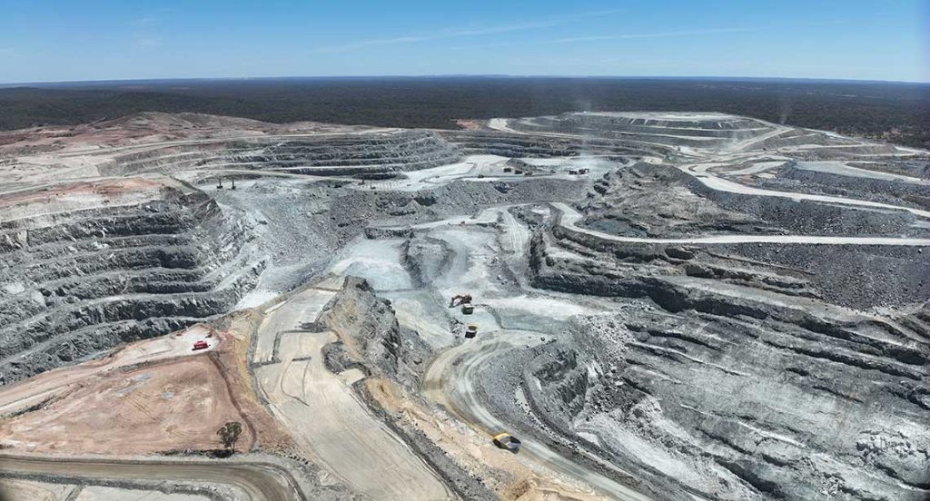
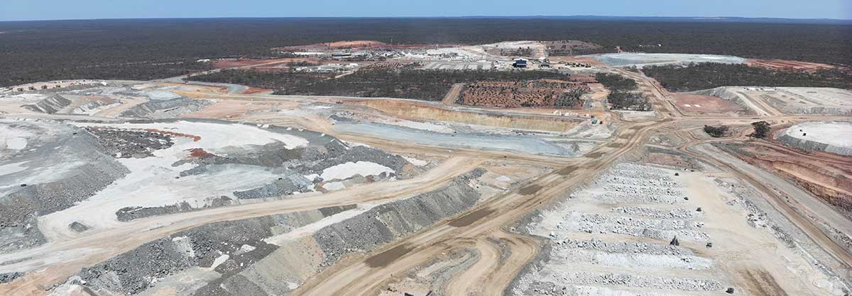
Mount Marion Lithium Mine is located 72km by road southwest of Kalgoorlie-Boulder in the Eastern Goldfields region of Western Australia. The project currently operates two open pits and an underground development.
Mount Marion employs conventional open pit drill, blast and haul mine operations and processes ore through its onsite primary and secondary crushers to feed the processing plant, which utilises a modular beneficiation circuit targeting Li2O at 6% chemical grade spodumene concentrate.
An exploration decline has been commenced and together with surface infrastructure will form the foundation for an ongoing underground operation.

Implementing a Maptek laser scanner and Maptek PointStudio software has transformed the previous conventional survey approach. The process is safer and faster, and confidence and respect has grown for the survey team, that the data they produce adds value to the business.
Senior Mining Surveyor, Michael Sadural has more than 15 years open pit survey experience in Australia and overseas across coal, copper, gold, iron ore and lithium operations.
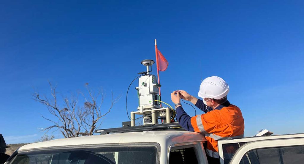
Sadural has been using a Maptek XR3 laser scanner for several years and finds the combination with Maptek Drive for mobile operation, an excellent addition to their survey arsenal.
‘Maptek Drive was a game changer, lessening the risk of surveyor interaction and exposure to mining equipment and environmental hazards such as dust,’ Sadural said. ‘It also allows us to deliver results much faster to our stakeholders to allow them to do their job better.’
Sadural finds the survey tools straightforward to use and operate, allowing them to deliver results to stakeholders much faster.
‘Reliable performance is critical in harsh weather conditions, when you need to rely on systems to operate as expected without delaying production,’ Sadural said.
Survey data represents the moment of truth—we provide accurate and reliable data for our teams to plan more productively and wisely.
Mount Marion applies specialised PointStudio add-ons for geotechnical analysis and design conformance. The data produced by the survey team is used by all departments who share common operational goals to safely and efficiently meet production goals.
‘Less re-work arises from having accurate data to feed into planning,’ Sadural said. ‘Maptek solutions connect seamlessly to our operation. It is a one-stop shop from data acquisition to data processing and delivering the result to our stakeholders.’
Versatility to transform survey data into valuable decision support information for multiple departments is an important consideration.
‘For example, topographic surfaces, design conformance reports and volume calculations can be seamlessly prepared from the one dataset,’ Sadural added.
One challenge arises at Mount Marion when adverse weather conditions threaten end of month survey. Maptek Drive ensures the survey team can quickly acquire data and deliver reports on time. PointStudio software proves ideal for processing pointclouds, filtering data efficiently and producing reports.

Mount Marion deploys various spatial technologies, depending on the purpose. Specific approaches are chosen to ensure full coverage of the pit, topography or stockpile. UAV is used for the majority of mine survey tasks due to its compact, easy setup and extended coverage beyond line of sight, with Maptek systems for specialised tasks.
‘We use the laser scanner mounted on a vehicle for high resolution scans of the highwall for detailed geotechnical analysis and mapping,’ Sadural added. ‘And deploy the rapid mobile scanning mode to survey for drill pattern surfaces and dig faces.’
Advantages
The dedicated mining solutions developed by Maptek allow the Mount Marion survey team to gather data efficiently and safely, and create an accurate terrain model to fulfil operational needs.
‘We have been able to greatly improve our site survey process, and upskill surveyors on conducting surveys and processing the data,’ Sadural concluded.
Sadural appreciates the positive relationship with Maptek and believes the innovative technologies make his job as a surveyor easier.
The operation realises the benefits of having one system to manage survey data processing, modelling and calculating volumes for open pit reconciliation of movement and stockpiles. Standout advantages are the accurate stockpile volumes and design conformance reporting.
Thanks to
Michael Sadural, Senior Mining Surveyor
Mineral Resources Limited
Mount Marion Lithium Mine
- Employing laser scanning and UAVs enhances survey accuracy, safety and efficiency while reducing environmental risks and improving stakeholder confidence at Mount Marion mine
- Maptek PointStudio software streamlines data processing, supporting diverse tasks like geotechnical analysis, volume calculations and design conformance from a unified dataset
- The combined use of advanced spatial technologies ensures timely, precise surveys under adverse conditions, meeting operational goals and minimising rework
Mount Marion has two open pits, 2km apart — North Pit around 1km² and Central Pit around 0.5km² — and an underground development. Total mining movement is planned for around 37.6Mt per year.

