The Grand Challenge for Data and Technology in Mining III

In this blog series I have introduced the Grand Challenge of today and discussed how Maptek is positioning itself to harness Big Data, the Internet of Things (IoT), and Artificial Intelligence (AI) & Machine Learning to deliver better decision making outcomes for the mining industry. You will have learnt how we’ve got our own Roadmap in place, but we cannot meet the Grand Challenge on our own.
Partnering for success
AI & Machine Learning techniques can rarely be made effective and practical without a lot of input from data scientists. Maptek is not a data science company but we have partnered with PETRA, which is. PETRA is also dedicated to serving the mining industry and so, like us, has relevant expertise.
Maptek Extend will offer the Workbench and Maptek Account as a platform for coding-minded users, data scientists, IT and development teams and indeed other technology companies. It opens the platform up so we can collectively solve problems and contribute to solutions.
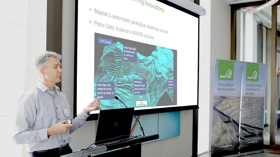
We have been working closely with PETRA recently to bring a breakthrough in mine scheduling. PETRA MAXTA can use all the ‘low veracity high volume big data’ from metallurgical plant history to predict the effect different blocks in the pit will have on plant performance. This prediction information is then written, via a web service using Maptek Extend, back into a block model so that scheduling can be visualised and planned on the basis of delivering better plant output rather than just tonnes and grade of primary ore to ROM. Such holistic modelling adds value to the entire mining process and is a fantastic example of bringing technologies together to meet the Grand Challenge.
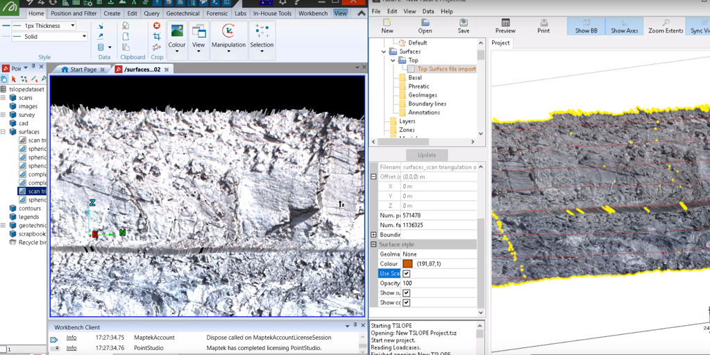
Another great example of the value Maptek Extend can bring to data management is that Tagasoft’s TSLOPE geotechnical stability simulation software can now read and write data directly from Maptek PointStudio while it is running.
It simply connects to PointStudio using Maptek Extend and lets the user directly browse into the PointStudio surfaces of interest from within TSLOPE.

PointStudio and TSLOPE have been integrated through Maptek Extend.
Maptek has a technology innovation partnership with Roy Hill Mining in Western Australia to tackle the Big Data challenge head on. If you’ve ever used Google docs, you will know that you can have many people simultaneously editing a spreadsheet or writing into the same report and – provided you have some kind of understanding about who is working where – everything just goes on in parallel really well – a bit like the real world. This project is about bringing that same thinking to big geospatial data starting with the mine site terrain model.
We start with baseline aerial surveys of the mining land form – up to six months old. Complementing this we have more frequent local surveys from a combination of drones, Maptek laser scanners, Drive systems and survey pickups.
Fleet management data full of GPS feeds regarding the location of digging and dumping events is then used to model the terrain in real time – extracting great value from it. If a less current but more accurate baseline is required, the fleet management data can be toggled on and off and – it’s a little like jumping in a time machine – the terrain from the last good known survey pops up instead.
All this is going to be available on the Workbench so that a snapshot can be taken of the terrain of interest and then used in other applications for planning, design and scheduling purposes. Eventually we will be extending the same concepts to subsurface structures too.
Facilitating better workflows across teams
Now you might be asking ‘What if I just use Vulcan for a job – fire it up, do what I have to do just using a couple of tools, then get out?’. That’s perfectly reasonable and is quite common usage.
But workflows that go between processes and people is a new area we are starting to look at. We’d like to get to the point where the hand-off of that job to the next system or person who needs that data is automated. That way they can come into the work with the right data presented, already there on their machine and loaded up with the next steps in the workflow outlined to them.
To meet the Grand Challenge it is an important step as it tightens the Deming cycle of process improvement I mentioned in Part II. Decisions of equal or better quality made with less time and effort are possible via this route.
AI & Machine Learning Innovations
The Maptek Workbench, Maptek Account and some Big Data technology are coming together to deliver an AI & Machine Learning approach to geological modelling. For some types of deposit, the resulting models are the equal of months of conventional geological interpretation and geostatistical work.

Read more: New paradigm for domain modelling
This is truly delivering on the elements of the Grand Challenge: Big Data – as every sample of every element of every hole has an influence; the IofT – because as soon as new information turns up from a drill rig or assay lab the model can be rebuilt automatically; and because the method contains AI & Machine Learning algorithms, the more holes you give it the better it learns the geology of the deposit.
Making the most of your data
Throughout this blog series I’ve given you a peek at the plumbing behind our products and shown how they are enabling integration, collaboration and innovation. You will have also seen how Maptek products combine to bring new approaches and solutions to delivering value from data.
We plan to continue improving each release of our existing products, as we always have, but you will increasingly see us focus on new systems and platforms, including workflows for automation, cloud computing and web services, big geospatial data management and delivery of AI & Machine Learning algorithms, because that’s how we can best work with you to meet the Grand Challenge.


