Maptek modelling and exploration technology at PDAC
Monday, March 7th, 2016
With the investment stream tap firmly in the off position, visitors to this year’s PDAC in Toronto will be keen to explore tools that provide confidence in the economics of their projects.
Maptek offers solutions ideal for modelling exploration data and mining scenarios that can be tested for different market conditions.
‘The crucial advantage of modelling is that you can explore ‘what-if’ options,’ said Maptek North American Solutions Specialist Ian Lipchak. ‘If the model shows the deposit isn’t viable to mine, you haven’t lost anything. And maybe you have learnt something.’
‘If you make a mistake in the real world, it quickly gets expensive. Better to get it correct at the start, from drilling in the right place to taking account of operational safety. The new tools in Vulcan 10 allow geologists to do more analysis on their data earlier on in the process.’
A mineral resource study for a flake graphite project in Australia provided the owner with the confidence to proceed toward the next stage of development. Vulcan variography and geostatistical tools were applied to grade interpolations, leading to a thorough understanding of the geology and prospects for mining.
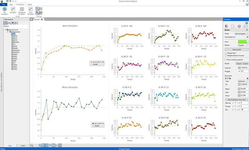
The Vulcan Data Analyser in Vulcan 10 presents a streamlined workflow. Users can easily set up and apply filters and transformations to data. A fan variogram compass allows easy testing of multiple directions for correlation of samples. Multiple models are displayed concurrently for conducting real-time, side-by-side comparisons. Processing is fast and changes to parameters are interactively displayed on relevant charts in real-time. High quality charts are easily output for incorporating into resource reports.

Sophisticated modelling techniques in Maptek systems are supported by advanced visualisation platforms for quickly communicating concepts and alternatives.
Users will be able to work with regular block models containing billions of blocks in Vulcan 10. Faster viewing of areas of interest is achieved by only using necessary processing power to zoom in at greater resolution.
‘There’s no need to compromise on resolution or data quality due to the size of the geological model. Users can cut models into slices and toggle through sections on screen and the display is modified seamlessly,’ added Lipchak.
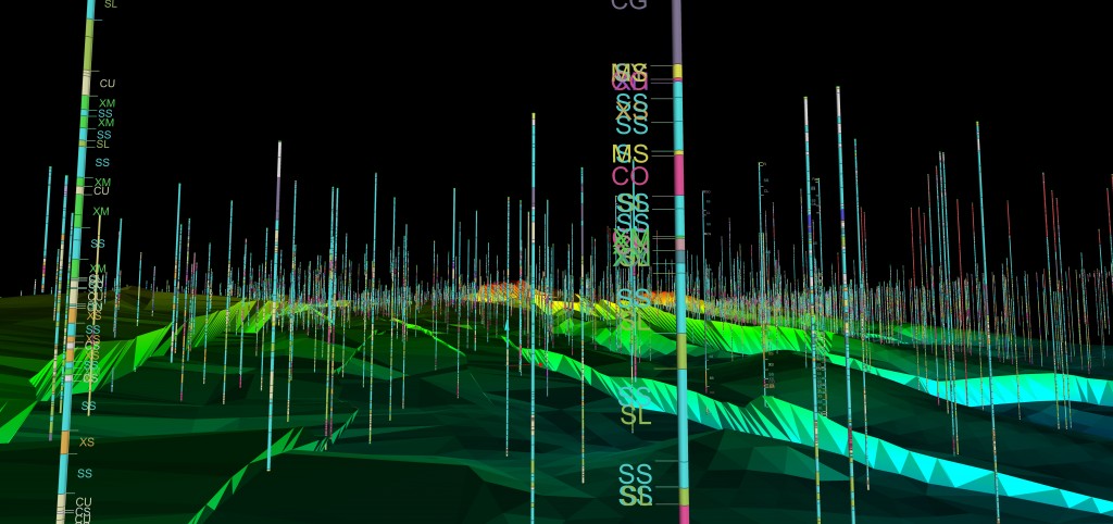
Maptek will also be demonstrating its specialist early stage exploration tools in Eureka. Eureka puts spatially located data into context for understanding the relationships between disparate information.
‘Displaying aerial photography, terrain maps, historical plans and GIS data at different scales allows you to see the big picture as well as analyse local areas of interest. When geophysical data such as seismic, gravity and magnetic surveys are viewed in the same space as exploration drilling data, intuitive correlations can be confirmed,’ Lipchak said.
Customers will receive a free 12-month trial of Eureka Core drillhole viewing and exploration tools alongside the Vulcan 10 release.

Companies with a well-defined resource will also be interested in Maptek optimisation and I-Site mine survey solutions. Optimisation techniques are popular because they provide clear evidence to demonstrate the economic potential to management and investors.
Evolution is an agile, dynamic solution for targeting complex, real world challenges.
‘Showing a scheduling and NPV optimisation tool at an investment event may seem unusual but when capital is difficult to come by people look for ways to add value to their deposit,’ Lipchak said. ‘There is no reason why you can’t run an early-stage geological model through an optimisation process to evaluate value.’
The latest I-Site survey technology will be on show at the Maptek booth. Pre-mining benefits include generating accurate terrain models for import into Eureka or Vulcan for 3D representation of the topography.
Maptek can be found at Booth #1039 at the PDAC in Toronto, March 6-9.


